29 June, 1pm:
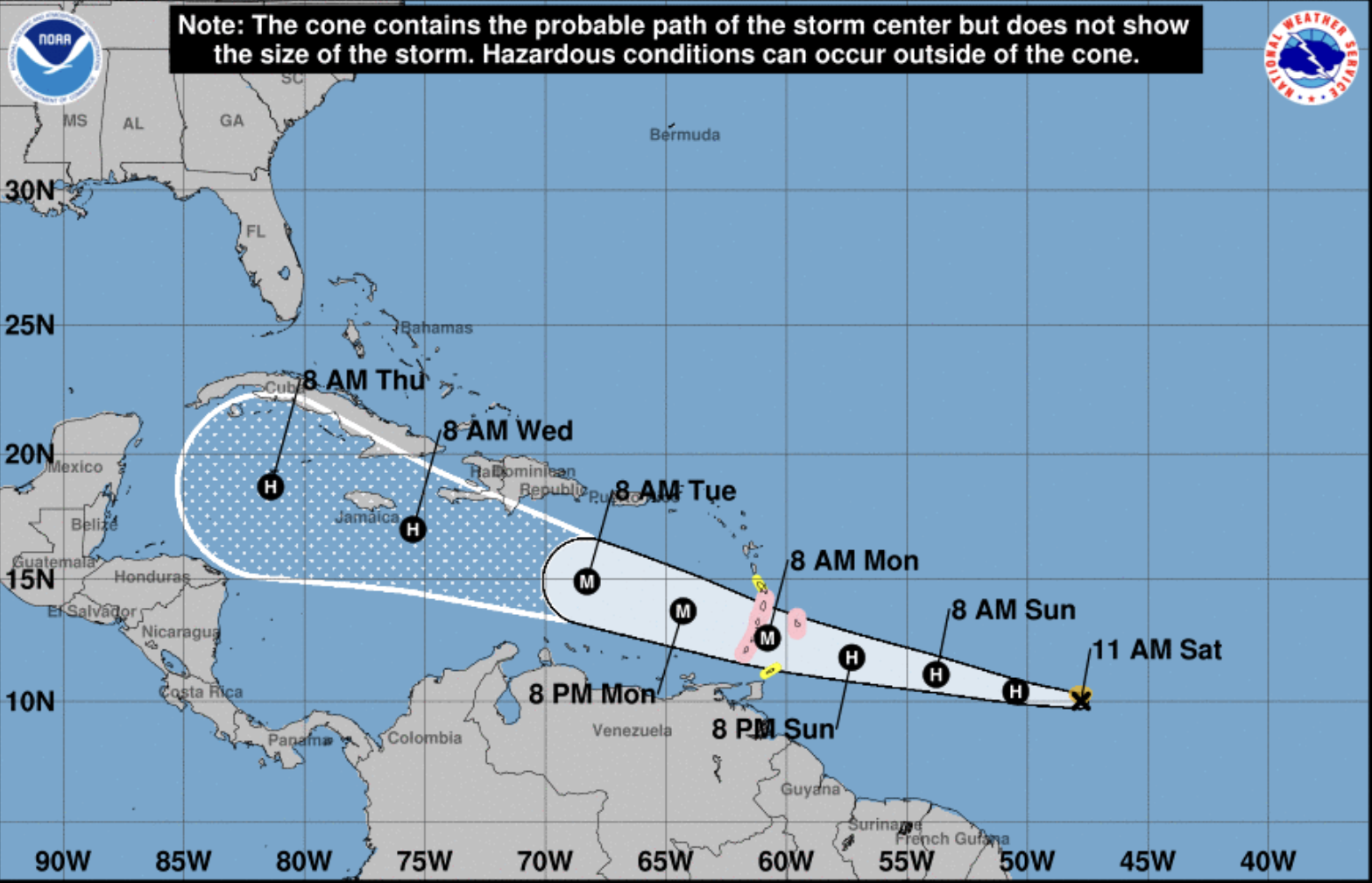
A tropical storm in the Atlantic Ocean that is heading west towards the Caribbean is forecast to become a hurricane later today and a major hurricane by Monday morning.
The cyclone, named Beryl, is barrelling towards the region at a speed of 23 miles per hour and is expected to reach Barbados, where a hurricane watch is in place, on Sunday evening.
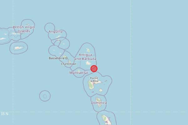
Also under hurricane watch are St Lucia, St Vincent and the Grenadines and Grenada, while a tropical storm watch is in effect for Martinique and Tobago.
The second named storm of the Atlantic hurricane season is likely to bring destructive hurricane-force winds, heavy rainfall, and life-threatening storm surges and waves.
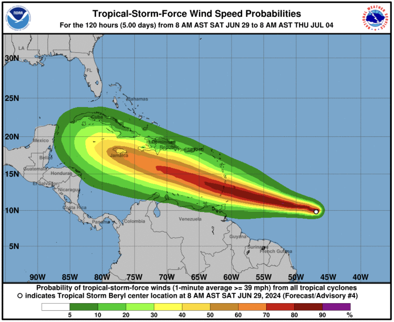
According to the National Hurricane Center, in a public advisory published at 11am this morning, 29 June, Beryl currently has maximum sustained winds of about 65mph with higher gusts.
The centre predicts that these winds, which extend outward up to 45 miles from the storm’s centre, will increase to at least 110mph at its peak intensity.
Monitor progress
A centre forecast said satellite images indicate that Beryl has been strengthening at a quick pace.
“The storm has been on a steady strengthening trend since it formed yesterday, and now that its structure is more symmetric and compact, it likely will have an opportunity to rapidly intensify given the low wind shear conditions,” it said.
Forecasters expect a life-threatening storm surge will raise water levels by as much as seven feet above normal tide levels in areas of onshore flow in the hurricane watch areas.
Near the coast, the surge will be accompanied by large and destructive waves, the hurricane centre added.
Tropical storm Beryl is forecast to produce rainfall totals of up to six inches across Barbados and the Windward Islands from Sunday night into Monday.
This rainfall may cause flooding in vulnerable areas, the centre said.
The forecast also predicts swells to reach the Windward and southern Leeward Islands by late Sunday, which are likely to cause life-threatening surf and rip current conditions.
The centre advises central and western Caribbean islands to closely monitor the storm’s progress.
Above average
In May, the National Oceanic and Atmospheric Administration (NOAA) predicted an above normal Atlantic hurricane season. This takes place from June 1 to November 30.
Experts forecast a range of 17 to 25 total named storms with winds of 39 miles per hour or higher. They expect eight to 13 to become hurricanes, with winds of 74 miles per hour or higher.
Of those, they have forecast four to seven to be major hurricanes, of category three, four or five, with winds of 111 miles per hour or higher.
Montserrat’s Disaster Management Coordination Agency (DMCA) director Alvin Ryan, in a Facebook video message on 1 June, urged residents to prepare.
“Action now can really help reduce the impacts of storms on our communities, reduce damage to property, and most importantly, save lives, which is the ultimate goal,” he said.
“Remember, it only takes one.”
Information on how to prepare for a hurricane is available in the DMCA’s 2024 Hurricane Preparedness Guide here.
Visit the National Hurricane Center for the latest weather updates at www.nhc.noaa.gov